Industry 4.0
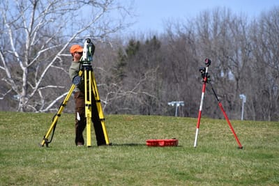
More than simple measurements, surveying is the first step in a project’s planning, design, and execution. Our surveying team has adapted the latest technology, making it possible to capture large amounts of highly accurate data faster than traditional surveying methods and create reliable 3D models for reference throughout a project’s life. From certified drone technology to mobile LiDAR mapping units, we provide the best solution for your unique project.
Areas of Expertise
- Boundary / right-of-way surveys
- American Land Title Association (ALTA) land title surveys
- Topographic design surveys
- Subdivision plats
- Construction staking or layout
- Route alignment and right-of-way surveys for roads, highways, railroads, and utilities
- Data acquisition for geographic information systems (GIS)
- Subsurface Utility Engineering (SUE) Investigations
- Unmanned Aerial Vehicle Systems (UAVs)
- Tax increment financing (TIF) district, zoning, annexation and corporate limit maps and descriptions

Augmented Reality Visualization
BIM Integration
Community Planning
Data Conversion
Digitization of Records
Environmental Data Analysis
Geodatabase Design
Geospatial Analysis
GPS Data Collection
Hydraulic Modeling
Mobile Application Development
Municipal Asset Management
Online Mapping
Raster Analysis
Special District Mapping
Wetland Delineation